Hayuliang | |
|---|---|
Town | |
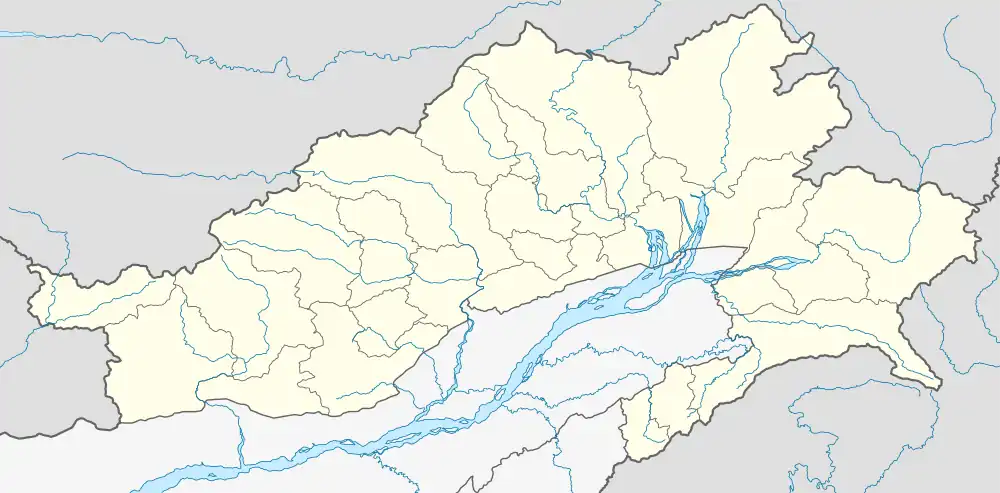
 Hayuliang Location in Arunachal Pradesh, India  Hayuliang Hayuliang (India) | |
| Coordinates: 28°03′46″N 96°32′53″E / 28.062885°N 96.548023°E | |
| Country | |
| State | Arunachal Pradesh |
| District | Anjaw district |
| Elevation | 1,240 m (4,070 ft) |
| Languages | |
| • Official | English |
| Time zone | UTC+05:30 (IST) |
| ISO 3166 code | IN-AR |
| Vehicle registration | AR |
Hayuliang is a town and the headquarters of an eponymous subdivision in the Anjaw district in the north-eastern state of Arunachal Pradesh, India.[1] It is on the bank of the Lohit River near the confluence of the Delei River.[2][3]
The Hayuliang subdivision, administered by an additional divisional commissioner (ADC), covers the entire Delei River basin including the Hayuliang Circle, Metengliang Circle, Goiliang Circle and the Chaglagam Circle. It is divided into two community development blocks, the Hayuliang–Goiliang block and the Chaglagam block.[4][3]
The region is populated by Mishmis, who speak Digaro Mishmi and Kaman Mishmi languages.[1]
Location
It is 308 km away from Arunachal Pradesh's capital Itanagar, 450 km from Imphal, 515 km from Dispur and 543 km from Shillong.
Nearest railway station is 235 km away at Tinsukia in Assam. Nearest airport is Tezu Airport 100 km away at district headquarter Tezu.
Climate
| Climate data for Hayuliang (1971–2000, extremes 1971–1985) | |||||||||||||
|---|---|---|---|---|---|---|---|---|---|---|---|---|---|
| Month | Jan | Feb | Mar | Apr | May | Jun | Jul | Aug | Sep | Oct | Nov | Dec | Year |
| Record high °C (°F) | 26.0 (78.8) |
27.4 (81.3) |
31.8 (89.2) |
32.5 (90.5) |
34.6 (94.3) |
39.0 (102.2) |
35.7 (96.3) |
38.9 (102.0) |
38.0 (100.4) |
34.0 (93.2) |
31.0 (87.8) |
30.5 (86.9) |
39.0 (102.2) |
| Mean daily maximum °C (°F) | 18.9 (66.0) |
18.8 (65.8) |
21.0 (69.8) |
22.7 (72.9) |
27.0 (80.6) |
29.2 (84.6) |
29.2 (84.6) |
30.6 (87.1) |
29.2 (84.6) |
26.9 (80.4) |
23.8 (74.8) |
20.9 (69.6) |
24.8 (76.6) |
| Mean daily minimum °C (°F) | 8.3 (46.9) |
9.7 (49.5) |
11.9 (53.4) |
14.2 (57.6) |
17.2 (63.0) |
20.3 (68.5) |
21.2 (70.2) |
21.5 (70.7) |
20.4 (68.7) |
16.8 (62.2) |
13.3 (55.9) |
10.0 (50.0) |
15.4 (59.7) |
| Record low °C (°F) | 3.0 (37.4) |
5.0 (41.0) |
8.0 (46.4) |
5.5 (41.9) |
10.0 (50.0) |
14.0 (57.2) |
15.2 (59.4) |
17.0 (62.6) |
16.0 (60.8) |
10.5 (50.9) |
8.0 (46.4) |
4.0 (39.2) |
3.0 (37.4) |
| Average rainfall mm (inches) | 97.5 (3.84) |
233.6 (9.20) |
396.3 (15.60) |
779.1 (30.67) |
360.1 (14.18) |
560.3 (22.06) |
421.7 (16.60) |
214.3 (8.44) |
239.6 (9.43) |
251.7 (9.91) |
58.5 (2.30) |
83.5 (3.29) |
3,696.1 (145.52) |
| Average rainy days | 6.4 | 10.3 | 14.4 | 16.9 | 13.2 | 14.9 | 16.5 | 9.7 | 10.1 | 8.1 | 3.2 | 3.6 | 127.3 |
| Average relative humidity (%) (at 17:30 IST) | 76 | 76 | 79 | 79 | 81 | 80 | 82 | 81 | 81 | 80 | 77 | 77 | 79 |
| Source: India Meteorological Department[5][6] | |||||||||||||
Transport
It is located on the 2,000-kilometre-long (1,200 mi) proposed Mago-Thingbu to Vijaynagar Arunachal Pradesh Frontier Highway along the McMahon Line,[7][8][9][10] alignment map of which can be seen here and here.[11]
See also
References
- 1 2 Hayuliang, Anjaw District website, retrieved 5 July 2021.
- ↑ Delei River, India, mindat.org, retrieved 5 July 2021.
- 1 2 Map of Anjaw, Anjaw District website, retrieved 5 July 2021.
- ↑ Subdivision & Blocks, Anjaw District website, retrieved 5 July 2021.
- ↑ "Station: Hayuliang Climatological Table 1971–2000" (PDF). Climatological Normals 1971–2000. India Meteorological Department. October 2011. pp. 313–314. Archived from the original (PDF) on 15 February 2020. Retrieved 15 February 2020.
- ↑ "Extremes of Temperature & Rainfall for Indian Stations (Up to 2012)" (PDF). India Meteorological Department. December 2016. p. M21. Archived from the original (PDF) on 5 February 2020. Retrieved 15 February 2020.
- ↑ "Top officials to meet to expedite road building along China border". Dipak Kumar Dash. timesofindia.indiatimes.com. Retrieved 27 October 2014.
- ↑ "Narendra Modi government to provide funds for restoration of damaged highways". Daily News and Analysis. Retrieved 27 October 2014.
- ↑ "Indian Government Plans Highway Along Disputed China Border". Ankit Panda. thediplomat.com. Retrieved 27 October 2014.
- ↑ "Govt planning road along McMohan line in Arunachal Pradesh: Kiren Rijiju". Live Mint. Retrieved 26 October 2014.
- ↑ "China warns India against paving road in Arunachal". Ajay Banerjee. tribuneindia.com. Retrieved 26 October 2014.