Hạ Hòa district
Huyện Hạ Hòa | |
|---|---|
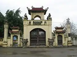
 Entrance to Đền thờ Mẫu Âu Cơ | |
| Country | |
| Region | Northeast |
| Province | Phú Thọ |
| Capital | Hạ Hòa |
| Area | |
| • Total | 130 sq mi (340 km2) |
| Population (2003) | |
| • Total | 108,556 |
| Time zone | UTC+7 (Indochina Time) |
Hạ Hòa is a rural district of Phú Thọ province in the Northeast region of Vietnam. As of 2003, the district had a population of 108,556.[1] The district covers an area of 340 km². The district capital lies at Hạ Hòa.[1]
Administrative divisions
The district consists of the district capital, Hạ Hòa, and 32 communes: Lệnh Khanh, Cáo Điền, Ấm Hạ, Phương Viên, Hậu Bổng, Đại Phạm, Đan Hà, Gia Điền, Y Sơn, Yên Luật, Lang Sơn, Chính Công, Yên Kỳ, Mai Tùng, Liên Phương, Hà Lương, Hương Xạ, Vụ Cầu, Minh Hạc, Vĩnh Chân, Phụ Khánh, Đan Thượng, Minh Côi, Văn Lang, Vô Tranh, Bằng Giã, Chuế Lưu, Xuân Áng, Lâm Lợi, Quân Khê, Hiền Lương and Động Lâm.
References
- 1 2 "Districts of Vietnam". Statoids. Retrieved March 23, 2009.
This article is issued from Wikipedia. The text is licensed under Creative Commons - Attribution - Sharealike. Additional terms may apply for the media files.
