Municipality of Gostivar
Општина Гостивар Komuna e Gostivarit | |
|---|---|
Urban municipality | |
 Flag  Coat of arms | |
 | |
| Country | |
| Region | |
| Municipal seat | Gostivar |
| Government | |
| • Mayor | Arben Taravari (AA) |
| Area | |
| • Total | 513.39 km2 (198.22 sq mi) |
| Population | |
| • Total | 59,770 |
| • Density | 158/km2 (410/sq mi) |
| Time zone | UTC+1 (CET) |
| Website | Official Website |

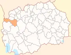
Gostivar (Macedonian: Гостивар [ˈɡɔstivar] ⓘ; Albanian: Komuna e Gostivarit) is a municipality in the western part of North Macedonia. Gostivar is also the name of the town where the municipal seat is found. The municipality is part of the Polog Statistical Region.
Geography
The municipality borders
- the Mavrovo and Rostuša, Kičevo municipalities to the south,
- Makedonski Brod Municipality to the east,
- Brvenica and Vrapčište municipalities to the north, and
- Albania and Kosovo to the west.
Demographics
The municipality has 35 inhabited places, one town and 34 villages.
According to the last national census from 2021 this municipality has 59,770 inhabitants.[1]
| 2002 | 2021 | |||
| Number | % | Number | % | |
| TOTAL | 81,042 | 100 | 59,770 | 100 |
| Albanians | 54,038 | 66.7 | 33,076 | 55.34 |
| Macedonians | 15,877 | 19.6 | 12,807 | 21.43 |
| Turks | 7,991 | 9.9 | 7,597 | 12.71 |
| Roma | 2,237 | 2.8 | 2,237 | 3.8 |
| others | 899 | 1 | 644 | 1.02 |
| Persons for whom data are taken from administrative sources | n/a | n/a | 3,409 | 5.7 |
Mother tongues among the municipality residents include:[2]
- Albanian: 33,204 (55.6%)
- Macedonian: 14,313 (24.0%)
- Turkish: 7,576 (12.7%)
- Persons for whom data are taken from administrative sources: 3,409 (5.7%)
- Romani: 1,087 (1.8%)
- Others: 181 (0.3%)
History
Several villages were burned down in Gostivar during 1912-16 by Serbian and Bulgarian forces.[3] Two of these villages were Reč, which had a population in 1900 of 140 Muslim Albanians and 150 Orthodox Albanians, and Strezimir which at that time was inhabited by 56 Muslim Albanians and 180 Orthodox Albanians.[4] Another such example is Štirovica.
On 26 November 2019, an earthquake struck Albania and Gostivar Municipality contributed humanitarian aid and teams of firefighters and doctors toward the relief effort for earthquake victims.[5]
References
- ↑ "Вкупно резидентно население во Република Северна Македонија според изјаснувањето за етничката припадност, по пол, по општини, Попис 2021".
- ↑ 2021 census, municipality by mother tongue
- ↑ Osmani 2012, p. 9."Tërnica, Reçi, Boletini, Dëbova, Strezimiri, Zavojska dhe Shtirovica deri në vitin 1916 u dogjën nga serbët dhe bullgarët. [Tërnica, Reçi, Boletini, Dëbova, Strezimiri, Zavojska and Shtirovica until 1916 were burned by Serbs and Bulgarians.]"
- ↑ Vasil Kanchov (1900). Macedonia: Ethnography and Statistics. Sofia. p. 91, 263.
- ↑ "Komunat shqiptare në Maqedoni anulojnë kremtimet për festat e nëntorit" (in Albanian). Gazeta Express. 27 November 2019. Archived from the original on 28 November 2019. Retrieved 29 November 2019.
Works cited
- Osmani, Edibe Selimi (2012). Veshja autoktone e femrave të Rekës së Epërme [Authentic clothing of women from Reka e Epërme]. Skopje: Arbëria design. ISBN 9789989578281.