| Glen Canyon National Recreation Area | |
|---|---|
 Reflection Canyon | |
  | |
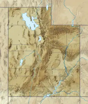
| Location | Kane, San Juan, Garfield, and Wayne counties, Utah & Coconino County, Arizona, United States |
| Nearest city | Page, Arizona, Bullfrog, Utah |
| Coordinates | 36°59′37″N 111°29′13″W / 36.99361°N 111.48694°W |
| Area | 1,254,117 acres (5,075.23 km2)[1] |
| Established | October 27, 1972 |
| Visitors | 2,842,776 (in 2022)[2] |
| Governing body | National Park Service, Bureau of Reclamation |
| Website | Glen Canyon National Recreation Area |

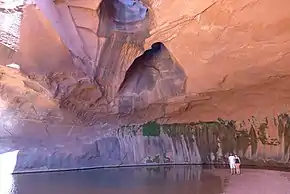
Glen Canyon National Recreation Area (shortened to Glen Canyon NRA or GCNRA) is a national recreation area and conservation unit of the United States National Park Service that encompasses the area around Lake Powell and lower Cataract Canyon in Utah and Arizona, covering 1,254,429 acres (5,076.49 km2) of mostly rugged high desert terrain. The recreation area is named for Glen Canyon, which was flooded by the Glen Canyon Dam, completed in 1966, and is now mostly submerged beneath the waters of Lake Powell.
Glen Canyon NRA borders Capitol Reef National Park and Canyonlands National Park on the north, Grand Staircase–Escalante National Monument on the west, Vermilion Cliffs National Monument and the northeasternmost reaches of Grand Canyon National Park on the southwest, and the Navajo Nation on the southeast. The southwestern end of Glen Canyon NRA in Arizona can be accessed via U.S. Route 89 and State Route 98. State Route 95 and State Route 276 lead to the northeastern end of the recreation area in Utah.
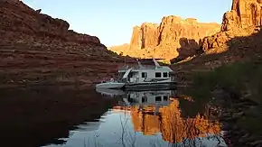
Glen Canyon NRA was established in 1972 "to provide for public use and enjoyment and to preserve the area's scientific, historic, and scenic features." The stated purpose of Glen Canyon NRA is for recreation as well as preservation (whereas a national park may carry more emphasis on natural preservation). As such, the area has been developed for access to Lake Powell via five marinas, four public campgrounds, two small airports, and numerous houseboat rental concessions.
Geology

The geology of the area is dominated by the Glen Canyon Group, consisting of the Navajo Sandstone, Kayenta Formation, and Wingate Sandstone.[3] The entire stratigraphic section includes rocks dating from the Cretaceous to Pennsylvanian periods.[4]
Recreation
Lake Powell has nearly 2,000 miles (3,200 km) of fish-holding shoreline and provides opportunities to fish for largemouth bass, smallmouth bass, and striped bass that swim in the waters of the recreation area.

Several local marinas and sports outfitters provide houseboats, powerboats, jet skis, kayaks, fishing gear, and related equipment to visitors.
Graffiti Removal and Intervention Team (GRIT)
With millions of visitors to the recreation area each year, it is inevitable that vandals will deface the rock faces of the canyon. Glen Canyon NRA has implemented a voluntourism program wherein volunteers sign up for a five-day houseboat trip during which they help remove graffiti from the canyon walls.[5]
See also
References
- ↑ "Listing of acreage – December 31, 2011" (XLSX). Land Resource Division, National Park Service. Retrieved 2012-12-14. (National Park Service Acreage Reports)
- ↑ "NPS Annual Recreation Visits Report". National Park Service. Retrieved 2023-07-23.
- ↑ "Summary of Geologic History". Archived from the original on 2009-12-26. Retrieved 2010-05-20.
- ↑ "Stratigraphic Columns" (PDF). Nps.gov. Archived from the original (PDF) on 2017-02-09. Retrieved 2016-07-18.
- ↑ "Graffiti Removal and Intervention Team". Glen Canyon NRA. National Park Service. Retrieved 2018-05-03.
External links
- Official National Park Service site
- Official National Park Service Concessionaire Site Lake Powell Resorts & Marinas, managed by Aramark, is an authorized concessioner of the National Park Service, Glen Canyon National Recreation Area.
- Glen Canyon Conservancy
- Page Lake Powell Chamber of Commerce


