Emerson Avenue Addition Historic District | |
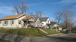
 Walnut east of Leland in Indianapolis, January 2013 | |
   | |
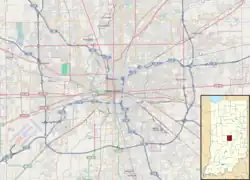
| Location | Roughly bounded by E. Michigan and E. St Clair Sts., N. Emerson Ave., and Ellenberger Park, Indianapolis, Indiana |
|---|---|
| Coordinates | 39°46′37″N 86°04′52″W / 39.77694°N 86.08111°W |
| Area | 143 acres (58 ha) |
| Architect | Sears, Roebuck & Co.; Montgomery Ward; Alladin; et al. |
| Architectural style | Tudor Revival, Colonial Revival, Bungalow/craftsman |
| MPS | Historic Residential Suburbs in the United States, 1830-1960 MPS |
| NRHP reference No. | 12001063[1] |
| Added to NRHP | December 19, 2012 |
Emerson Avenue Addition Historic District, also known as Emerson Heights Addition and Charles M. Cross Trust Clifford Avenue Addition, is a national historic district located at Indianapolis, Indiana. It encompasses 1,000 contributing buildings and 9 contributing objects in a planned residential section of Indianapolis. The district developed between about 1910 and 1949, and includes representative examples of Tudor Revival, Colonial Revival, and Bungalow / American Craftsman style residential architecture.[2]
It was listed on the National Register of Historic Places in 2012.[1]
References
- 1 2 "National Register of Historic Places Listings". Weekly List of Actions Taken on Properties: 12/17/12 through 12/21/12. National Park Service. December 28, 2012.
- ↑ "Indiana State Historic Architectural and Archaeological Research Database (SHAARD)" (Searchable database). Department of Natural Resources, Division of Historic Preservation and Archaeology. Retrieved August 1, 2016. Note: This includes Connie J. Ziegler (April 2009). "National Register of Historic Places Inventory Nomination Form: Emerson Avenue Addition Historic District" (PDF). Retrieved August 1, 2016. and Accompanying photographs
This article is issued from Wikipedia. The text is licensed under Creative Commons - Attribution - Sharealike. Additional terms may apply for the media files.