Elysian Valley
Frogtown | |
|---|---|
 | |
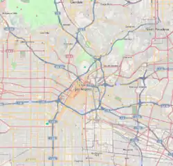
 Elysian Valley Location within Northeast Los Angeles | |
| Coordinates: 34°05′40″N 118°14′25″W / 34.09445°N 118.240366°W | |
| Country | |
| State | |
| County | |
| Time zone | Pacific |
| Zip Code | 90031, 90039 |
| Area code | 323 |
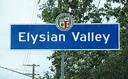
Elysian Valley, commonly known as Frogtown,[1] is a neighborhood in Central Los Angeles, California, adjoining the Los Angeles River. It has two parks, both maintained by the Mountains Recreation and Conservation Authority (MRCA). The Frogtown Art Walk is a biennial event managed by the Elysian Valley Arts Collective to celebrate local area artists. Knightsbridge Theatre is a repertory theater company located in the neighborhood.
History

In the late 1800s and early 1900s, Elysian Valley was home to a number of farms. These farmers carted their produce down the road to sell in the markets of downtown Los Angeles and emerging suburbs like Angelino Heights. In 1910, the city annexed the farmland. In 1911, Southern Pacific Railroad's Taylor Yard was built just across the river. In 1913, the land started being subdivided for residential development.[2]
Sometime between the 1930s and 1960s, the neighborhood became known as Frogtown when swarms of Western toads invaded its streets.[2] In 1962, the Golden State Freeway removed a section of the western flank of Frogtown, further isolating it from nearby neighborhoods.[2]
Michael Todd, one of the unofficial founding fathers of the Frogtown art scene, has had a studio in the neighborhood since the mid-1980s.[3] By 2014, artists Shepard Fairey, Mark Grotjahn, and Thomas Houseago had opened studios in the community.[1]
In July 2019, it was reported that Frogtown was undergoing "inexorable change" due to gentrification.[4] With the announcement of a $1 billion restoration project for the Los Angeles River, also known as Alternative 20, many residents felt the pressure of new investment and development in the community, causing them to organize for lower density.[5] This push for low density from within the neighborhood is not new and was documented in an article as far back as 1987.[6]
Geography

According to the Mapping L.A. project of the Los Angeles Times, Elysian Valley is bounded by the Los Angeles River on the north and east, Riverside Drive on the west and Fletcher Drive on the northwest.[7]
The neighborhood is flanked on the north by Atwater Village, on the northeast and east by Glassell Park, on the southeast by Cypress Park, on the south and southwest by Elysian Park, and on the west and northwest by Echo Park and Silver Lake.[8][9]
Population
The 2000 U.S. census counted 7,387 residents in the 0.79-square-mile neighborhood—an average of 9,354 people per square mile, about the same population density as the rest of the city. In 2008, the city estimated that the population had increased to 7,781. The median age for residents was 31, about average for Los Angeles, but the percentage of residents aged 11 to 18 was among the county's highest.[7]
The neighborhood is moderately diverse ethnically, and the percentage of Asians and Latinos is comparatively high. The breakdown in 2000 was Latinos, 61.0%; Asians, 35.9%; whites, 9.7%; blacks, 1.1%; and others, 2.6%. Mexico was the most common places of birth for the 47.5% of the residents who were born abroad, a high figure compared to rest of the city.[7]
The median yearly household income in 2008 dollars was $49,013, about the same as the rest of Los Angeles. The average household size of 3.4 people was high for the city of Los Angeles. Renters occupied 52.2% of the housing stock, and house- or apartment-owners 47.8%.[7]
Seventeen percent of the neighborhood residents aged 25 and older had earned a four-year degree by 2000, an average figure for the city.[7]
Education
Los Angeles Unified School District has two schools in Elysian Valley:
- Dorris Place Elementary — 2225 Dorris Place[10]
- Allesandro Elementary — 2210 Riverside Drive
Landmarks and attractions

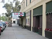
- Knightsbridge Theatre — 1944 Riverside Drive. Formerly the Colony Theater,[11] Knightsbridge Theatre is home to a repertory theater company, with a second location in Pasadena.[12]
- Suay Sew Shop[13] - 2915 Knox Ave #105. A sustainable clothing and accessory company.
Events
Parks and recreation

Elysian Valley has three parks, all maintained by the Mountains Recreation and Conservation Authority (MRCA):
- Egret Park — features a viewpoint, native plantings, and interpretive displays along with access to the Los Angeles River bicycle path.[15]
- Steelhead Park — has a small outdoor amphitheater for education. Steelhead trout adorn the top of the park's wrought-iron fencing.[16]
- Rattlesnake Park — The park has an entrance off Fletcher Drive, south of the LA River.
In media
According to the Los Angeles Times, Dorris Place Elementary is "probably the most filmed elementary school in the United States." With elegant brick work and dark wood trim, the school has an "East Coast" appearance. In the 1985-86 school year, the school was used for commercials for Ralston Purina, the California State Lottery, the Church of Jesus Christ of Latter-day Saints, Burger King, National Education Association, and Kleenex. Over that time, Dorris Place received $4,400 from filmmakers. The money was used to buy computers, software, and basketball uniforms.[17] The school's facade has appeared in Cold Case, Freaky Friday, Unlawful Entry,[18] and Lucifer.[19]
Religion
Religious congregations include:
- St. Ann Catholic Parish — 2302 Riverdale Avenue
- St. Mary Coptic Catholic Church — 2701 Newell Avenue
- Kadampa Meditation Center — 1492 Blake Avenue
References
- 1 2 3 Isaac Simpson (August 20, 2014). "L.A.'s Hottest New Neighborhood, Frogtown, Doesn't Want the Title". LA Weekly. Archived from the original on August 28, 2014. Retrieved August 20, 2016.
Its official name, Elysian Valley, is rarely used.
- 1 2 3 Garner, Scott (August 10, 2018). "Neighborhood Spotlight: Elysian Valley". Los Angeles Times. Retrieved April 15, 2021.
- ↑ Rees, Brenda (May 23, 2019). "Five Questions for Elysian Valley Artist Michael Todd on the eve of the Frogtown Art Walk". Retrieved April 15, 2021.
- ↑ https://capitalandmain.com/watching-another-los-angeles-neighborhood-gentrify-0717/,full.story Barron of Frogtown: Watching L.A. change with “the Willy Wonka of rusted metal"
- ↑ Jao, Carren (October 9, 2014). "Elysian Valley Residents Push for Smart Growth". kcet.org.
- ↑ McMillan, Penelope (March 8, 1987). "Elysian Valley : Frogtown Holds Bucolic 'Secret' Minutes From Downtown L.A." Los Angeles Times.
- 1 2 3 4 5 "Elysian Valley," Mapping L.A., Los Angeles Times
- ↑ "Central L.A.," Mapping L.A., Los Angeles Times
- ↑ "Northeast," Mapping L.A., Los Angeles Times
- ↑ "Elysian Valley Schools," Mapping L.A., Los Angeles Times
- ↑ "Knightsbridge Theatre History". knightsbridgetheatre.com. Retrieved April 15, 2021.
- ↑ "Knightsbridge Offers Four New Show at Its Two Locations". Playbill.com. December 10, 2000. Retrieved April 15, 2021.
- ↑ Stuart, Gwynedd (January 14, 2021). "During the Pandemic, Frogtown's Suay Sew Shop Took Its Activist Mission to the Next Level". Los Angeles Magazine. Retrieved August 8, 2022.
- ↑ Boone, Lisa (September 6, 2018). "Explore pop-up galleries, artists' studios and more along the Los Angeles River at the Frogtown Artwalk". Los Angeles Times. Retrieved April 15, 2021.
- ↑ "Egret Park". Mountains Recreation and Conservation Authority. Retrieved April 15, 2021.
- ↑ "Steelhead Park". Mountains Recreation and Conservation Authority. Retrieved April 15, 2021.
- ↑ Biederman, Patricia Ward (March 1, 1987). "Campuses Make Popular Film Locations". Los Angeles Times. Retrieved April 15, 2021.
- ↑ "Filming Location Matching "Dorris Place Elementary School - 2225 Dorris Place, Los Angeles, California, USA" (Sorted by Popularity Ascending)". IMDb. Retrieved November 4, 2020.
- ↑ "Movies Filmed at Dorris Place Elementary School". MovieMaps.org. Retrieved April 15, 2021.
External links
- Mapping Frogtown: Elysian Valley (Video)
- Elysian Valley crime map and statistics