Elmadağ | |
|---|---|
District and municipality | |
 | |
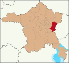
 Map showing Elmadağ District in Ankara Province | |
 Elmadağ Location in Turkey  Elmadağ Elmadağ (Turkey Central Anatolia) | |
| Coordinates: 39°55′15″N 33°13′51″E / 39.92083°N 33.23083°E | |
| Country | Turkey |
| Province | Ankara |
| Government | |
| • Mayor | Adem Barış Aşkın (CHP) |
| Area | 647 km2 (250 sq mi) |
| Elevation | 1,135 m (3,724 ft) |
| Population (2022)[1] | 44,379 |
| • Density | 69/km2 (180/sq mi) |
| Time zone | TRT (UTC+3) |
| Postal code | 06780 |
| Area code | 0312 |
| Website | www |
Elmadağ is a municipality and district of Ankara Province, Turkey.[2] Its area is 647 km2,[3] and its population is 44,379 (2022).[1] Its average elevation is 1,135 m (3,724 ft), with the highest point being Mt. İdris at 1,995 m (6,545 ft).
Places of interest
Elmadağ (1,862 m.) is also a small mountain beside the town, 45 km from the cıty of Ankara on the road to Kırıkkale. Residents of Ankara often visit the area for picnics and to learn to ski or snowboard during the skiing season which lasts from December until March. There are hotels, student accommodation, cafes and places selling hot-dogs and other apres-ski food.
Composition
There are 30 neighbourhoods in Elmadağ District:[4]
- Akçaali
- Aşağıkamışlı
- Deliler
- Ediğe
- Gümüşpala
- Hasanoğlan Bahçelievler
- Hasanoğlan Fatih
- Hasanoğlan Havuzbaşı
- İsmetpaşa
- İstasyon
- Karacahasan
- Kayadibi
- Kemalpaşa
- Kurtuluş
- Kuşçuali
- Lalabel
- Muzaffer Ekşi
- Şehitlik
- Seyitcemali
- Süleymanlı
- Taburlar
- Tatlıca
- Tekkeköy
- Üçevler
- Yenice
- Yenidoğan
- Yenimahalle
- Yenipınar
- Yeşildere Fatih
- Yukarıkamışlı
References
- 1 2 "Address-based population registration system (ADNKS) results dated 31 December 2022, Favorite Reports" (XLS). TÜİK. Retrieved 22 May 2023.
- ↑ Büyükşehir İlçe Belediyesi, Turkey Civil Administration Departments Inventory. Retrieved 8 June 2023.
- ↑ "İl ve İlçe Yüz ölçümleri". General Directorate of Mapping. Retrieved 22 May 2023.
- ↑ Mahalle, Turkey Civil Administration Departments Inventory. Retrieved 22 May 2023.
External links
- District governor's official website (in Turkish)
- District municipality's official website (in Turkish)
- Elmadağ Social Network (in Turkish)
- Governorship of Elmadağ, Turkey. "Brief history and geography of Elmadağ" (in Turkish). Archived from the original on 2008-02-13.
This article is issued from Wikipedia. The text is licensed under Creative Commons - Attribution - Sharealike. Additional terms may apply for the media files.
