El Paso Metropolitan Statistical Area | |
|---|---|
| El Paso, MSA | |
 Downtown El Paso | |
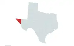
 El Paso metropolitan area in red | |
| State | |
| Area | |
| • Metropolitan statistical area | 5,587 sq mi (14,470 km2) |
| Population (2020)[1] | |
| • Urban | 854,584 (53rd) |
| • MSA | 868,859 (67th) |
| • CSA | 1,095,532 (56th) |
| GDP | |
| • MSA | $43.3 billion (2022) |
The El Paso Metropolitan Statistical Area, as defined by the United States Census Bureau, is an area consisting of two counties – El Paso and (since 2013) Hudspeth – in far West Texas, anchored by the city of El Paso. As of the 2020 United States Census, the MSA had a population of 868,859. The El Paso MSA forms part of the larger El Paso–Las Cruces combined statistical area, with a total population of 1,088,420[3] as of the 2020 United States Census.
Counties
Communities
| Census | Pop. | Note | %± |
|---|---|---|---|
| 1900 | 24,886 | — | |
| 1910 | 52,599 | 111.4% | |
| 1920 | 101,877 | 93.7% | |
| 1930 | 131,597 | 29.2% | |
| 1940 | 131,067 | −0.4% | |
| 1950 | 194,968 | 48.8% | |
| 1960 | 314,070 | 61.1% | |
| 1970 | 359,291 | 14.4% | |
| 1980 | 479,899 | 33.6% | |
| 1990 | 591,610 | 23.3% | |
| 2000 | 679,622 | 14.9% | |
| 2010 | 804,123 | 18.3% | |
| 2020 | 868,859 | 8.1% | |
| U.S. Decennial Census[4] | |||
Incorporated places
Census-designated places
Note: All census-designated places are unincorporated.
Unincorporated places
See also
- El Paso–Juárez, the binational metropolitan area of which this area forms a part
- Texas census statistical areas
References
- ↑ "U.S. Census website". United States Census Bureau. Retrieved April 18, 2019.
- ↑ "Total Gross Domestic Product for El Paso, TX (MSA)". fred.stlouisfed.org.
- ↑ "U.S. Census website". United States Census Bureau. Retrieved 2021-06-21.
- ↑ "U.S. Decennial Census". United States Census Bureau. Archived from the original on May 7, 2015. Retrieved May 28, 2013.
This article is issued from Wikipedia. The text is licensed under Creative Commons - Attribution - Sharealike. Additional terms may apply for the media files.