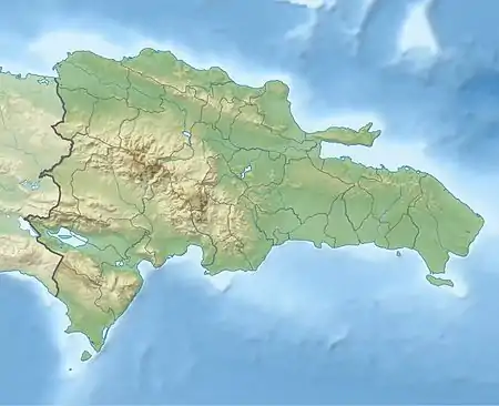
San Pedro de El Cercado | |
|---|---|
 Seal | |
 San Pedro de El Cercado El Cercado in the Dominican Republic | |
| Coordinates: 18°43′48″N 71°31′12″W / 18.73000°N 71.52000°W | |
| Country | |
| Province | San Juan |
| Area | |
| • Total | 283.05 km2 (109.29 sq mi) |
| Population (2012)[2] | |
| • Total | 25,688 |
| • Density | 91/km2 (240/sq mi) |
| • Urban | 2,585 |
| Municipal Districts | 2 |
El Cercado is a town in the San Juan province of the Dominican Republic.
History
The community of El Cercado was founded in 1845 by President Pedro Santana. It previously belonged to the municipality of Bánica and was called the Sabana del Bohío, and was elevated to town by President Fernando Arturo de Meriño in 1888. The first families to settle in this area were Florencio Montero, Telésforo de Oleo, Encarnación, Manuelica y Fidel Matos and Leonardo Brito. El Cercado people have the reputation for being very hospitable, friendly and kind.
The main economic source is agriculture consisting of cattle, snuff, honey, wax, leather and coffee. The main form of communication was the horse, which started the mail service.
Climate
El Cercado has a tropical savanna climate (Köppen climate classification: Aw).
| Month | Jan | Feb | Mar | Apr | May | Jun | Jul | Aug | Sep | Oct | Nov | Dec | Year |
|---|---|---|---|---|---|---|---|---|---|---|---|---|---|
| Record high °C (°F) | 33.5 (92.3) |
34.0 (93.2) |
35.1 (95.2) |
37.0 (98.6) |
35.1 (95.2) |
36.0 (96.8) |
36.5 (97.7) |
36.0 (96.8) |
37.0 (98.6) |
35.2 (95.4) |
38.0 (100.4) |
32.3 (90.1) |
38.0 (100.4) |
| Mean daily maximum °C (°F) | 27.9 (82.2) |
28.9 (84.0) |
30.1 (86.2) |
30.8 (87.4) |
30.1 (86.2) |
31.0 (87.8) |
31.7 (89.1) |
31.4 (88.5) |
31.0 (87.8) |
30.0 (86.0) |
28.7 (83.7) |
27.6 (81.7) |
29.9 (85.8) |
| Mean daily minimum °C (°F) | 13.0 (55.4) |
14.0 (57.2) |
15.0 (59.0) |
15.9 (60.6) |
17.0 (62.6) |
17.9 (64.2) |
17.7 (63.9) |
17.2 (63.0) |
17.1 (62.8) |
16.8 (62.2) |
15.3 (59.5) |
13.5 (56.3) |
15.9 (60.6) |
| Record low °C (°F) | 5.7 (42.3) |
7.2 (45.0) |
7.0 (44.6) |
8.0 (46.4) |
8.0 (46.4) |
10.0 (50.0) |
9.0 (48.2) |
9.0 (48.2) |
9.0 (48.2) |
9.0 (48.2) |
8.0 (46.4) |
7.0 (44.6) |
5.7 (42.3) |
| Average rainfall mm (inches) | 12.9 (0.51) |
20.3 (0.80) |
43.3 (1.70) |
120.6 (4.75) |
190.9 (7.52) |
83.2 (3.28) |
79.0 (3.11) |
138.5 (5.45) |
161.4 (6.35) |
164.3 (6.47) |
81.3 (3.20) |
19.5 (0.77) |
1,115.2 (43.91) |
| Average rainy days (≥ 1.0 mm) | 1.7 | 2.0 | 3.8 | 8.3 | 11.2 | 6.9 | 6.8 | 8.7 | 10.7 | 11.7 | 6.7 | 2.5 | 81.0 |
| Source: NOAA[3] | |||||||||||||
Personalities
References
- ↑ Superficies a nivel de municipios, Oficina Nacional de Estadistica Archived April 17, 2009, at the Wayback Machine
- ↑ Censo 2002 de Población y Vivienda, Oficina Nacional de Estadistica
- ↑ "El Cercado Climate Normals 1961-1990". National Oceanic and Atmospheric Administration. Retrieved September 12, 2016.
Sources
- World Gazeteer: Dominican Republic – World-Gazetteer.com