| Donald's Hill | |
|---|---|
| Knocknahurkle | |
 | |
| Highest point | |
| Elevation | 399 m (1,309 ft) |
| Listing | Marilyn |
| Geography | |
| Location | Drumsurn, Londonderry, Northern Ireland |
| OSI/OSNI grid | C758178 |
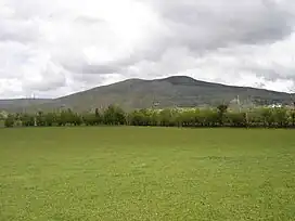
Donald's Hill (Irish: Cnoc Dhónaill),[1] or Knocknahurkle (Cnoc na hEarcola),[2] is a hill in County Londonderry, Northern Ireland. The summit is 399 metres (1,309 ft) above sea level and classifies it as a Marilyn.[2] It is part of the Keenaght Hills[2] and overlooks the village of Drumsurn.
Donald's Hill lies on the route of the North Sperrins Way section of the Ulster Way long-distance walking circuit.
References
Links
55°00′07″N 6°48′58″W / 55.00190°N 6.81623°W
This article is issued from Wikipedia. The text is licensed under Creative Commons - Attribution - Sharealike. Additional terms may apply for the media files.

