Dionysos
Διόνυσος | |
|---|---|
 Dionysos Skyline | |
 Dionysos Location within the region  | |
| Coordinates: 38°6′N 23°52′E / 38.100°N 23.867°E | |
| Country | Greece |
| Administrative region | Attica |
| Regional unit | East Attica |
| Government | |
| • Mayor | Giannis Kalafatelis (Ind.) |
| Area | |
| • Municipality | 69.36 km2 (26.78 sq mi) |
| • Municipal unit | 21.41 km2 (8.27 sq mi) |
| Elevation | 480 m (1,570 ft) |
| Population (2011)[1] | |
| • Municipality | 40,193 |
| • Municipality density | 580/km2 (1,500/sq mi) |
| • Municipal unit | 6,458 |
| • Municipal unit density | 300/km2 (780/sq mi) |
| Time zone | UTC+2 (EET) |
| • Summer (DST) | UTC+3 (EEST) |
| Postal code | 145 76 |
| Area code(s) | 210 |
| Vehicle registration | Z |
| Website | www.dimosdionysou.gr |
Dionysos (Greek: Διόνυσος) is a northern suburb of the Athens agglomeration and a municipality in northeastern Attica, Greece. The seat of the municipality is the town Agios Stefanos.[2]
Geography

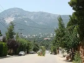
Dionysos is situated on the northeastern slopes of the forested Penteliko Mountains. It is 5 km south of Agios Stefanos, 9 km west of Nea Makri, on the Aegean Sea coast, and 18 km northeast of Athens city centre. Its built-up area is continuous with those of the neighbouring suburbs Drosia and Rodopoli to the northwest. Even though the town is located only 20 Kilometres away from central Athens, it has a completely different climate, with weather being significantly cooler, including frequent snowfall during the winter. Motorway 1 (Athens – Lamia – Thessaloniki) and the railway from Athens to Thessaloniki pass through the western part of the municipality, near Agios Stefanos. There is a railway station at Agios Stefanos. Dionysos is connected to Kifisia by the 536 Dionysos-Kifisia bus service.
Climate
Dionysos has a hot-summer Mediterranean climate (Köppen climate classification: Csa). Thrakomakedones experiences hot, relatively dry summers and cool, wet winters.
| Climate data for Dionysos | |||||||||||||
|---|---|---|---|---|---|---|---|---|---|---|---|---|---|
| Month | Jan | Feb | Mar | Apr | May | Jun | Jul | Aug | Sep | Oct | Nov | Dec | Year |
| Mean daily maximum °C (°F) | 9.07 (48.33) |
10.51 (50.92) |
13.03 (55.45) |
18.49 (65.28) |
24.45 (76.01) |
30.11 (86.20) |
31.59 (88.86) |
31.37 (88.47) |
27.83 (82.09) |
21.40 (70.52) |
15.06 (59.11) |
10.86 (51.55) |
20.31 (68.56) |
| Daily mean °C (°F) | 5.43 (41.77) |
6.09 (42.96) |
8.17 (46.71) |
12.71 (54.88) |
18.67 (65.61) |
24.39 (75.90) |
25.40 (77.72) |
25.65 (78.17) |
20.29 (68.52) |
15.30 (59.54) |
10.72 (51.30) |
7.52 (45.54) |
14.83 (58.69) |
| Mean daily minimum °C (°F) | 1.39 (34.50) |
1.59 (34.86) |
2.84 (37.11) |
5.71 (42.28) |
9.93 (49.87) |
15.14 (59.25) |
17.55 (63.59) |
16.69 (62.04) |
13.48 (56.26) |
8.97 (48.15) |
6.66 (43.99) |
3.76 (38.77) |
8.52 (47.34) |
| Average precipitation mm (inches) | 70.15 (2.76) |
66.15 (2.60) |
76.68 (3.02) |
46.33 (1.82) |
26.03 (1.02) |
11.80 (0.46) |
13.27 (0.52) |
12.36 (0.49) |
16.31 (0.64) |
68.31 (2.69) |
94.65 (3.73) |
91.75 (3.61) |
593.79 (23.38) |
| Mean monthly sunshine hours | 120.18 | 129.62 | 159.63 | 194.57 | 255.66 | 313.67 | 319.81 | 305.17 | 253.86 | 188.14 | 117.41 | 100.97 | 2,516.6 |
| Source: Hellenic National Meteorological Service[3] | |||||||||||||
History

The town was known by the Arvanitika name Tzamali (Τζαμάλη) up until 1928 when it was renamed Dionysos. The sanctuary of Dionysus of Icaria was rediscovered by archaeology in 1888.[4]
Culture
Dionysos hosts an annual open summer festival usually every July, featuring art exhibitions, theatrical performances, musical shows, sculpture painting and other arts. The public library of Dionysos is located in the town hall, includes over 3500 books available to registered residents to borrow for free. It is run by local volunteers.
Municipality
The municipality Dionysos was formed at the 2011 local government reform by the merger of the following 7 former municipalities, that became municipal units:[2]
The municipality has an area of 69.360 km2, the municipal unit 21.410 km2.[5]
Notable people
- Thespis, (6th century BC) actor
- Kostas Martakis, singer
- Aristi Tsipras, mother of the former Greek prime minister Alexis Tsipras
Gallery
 The St. George Chiopolitis church in Dionysos
 Penteli mountain as viewed from Dionysos
 Typical street in Dionysos
See also
References
- ↑ "Απογραφή Πληθυσμού - Κατοικιών 2011. ΜΟΝΙΜΟΣ Πληθυσμός" (in Greek). Hellenic Statistical Authority.
- 1 2 "ΦΕΚ A 87/2010, Kallikratis reform law text" (in Greek). Government Gazette.
- ↑ "Dionysos Climatic Data". Hellenic National Meteorological Service. Retrieved 15 March 2021.
- ↑ p. 44, Peter Green, From Ikaria to the stars, (Austin, 2004)
- ↑ "Population & housing census 1991 (incl. area and average elevation)" (in Greek). National Statistical Service of Greece.
External links
- Municipality of Dionysos
- White Marble of Dionissos-Penteli – greekmarble.com
- "White Marble of Dionissos-Penteli – marbleguide.gr". Archived from the original on 2005-02-09.
- Dionyssomarble group (Dionyssos – Pentelikon marble quarries)
- Dionissos White
