| Department | |
|---|---|
 | |
| Location | |
| Number | 14 |
| Populations |
|
| Areas | |
| Subdivisions | |
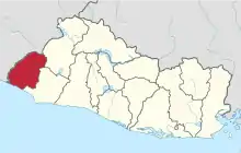
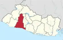
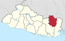
El Salvador is divided into 14 departments (Spanish: departamentos) for administrative purposes, subdivided into 44 municipalities (municipios) and 262 districts. The country is a unitary state.
Departments
| Map | Flag | Coat of arms | Department | ISO Code | Capital | Area (km2) | Population (2013)[1] | Municipalities | Districts |
|---|---|---|---|---|---|---|---|---|---|
 |
 |
Ahuachapán | SV-AH | Ahuachapán | 1,239.6 | 333,406 | 3 | 12 | |
 |
Cabañas | SV-CA | Sensuntepeque | 1,103.5 | 164,945 | 2 | 9 | ||
 |
Chalatenango | SV-CH | Chalatenango | 2,016.6 | 204,808 | 3 | 33 | ||
 |
Cuscatlán | SV-CU | Cojutepeque | 756.2 | 252,528 | 2 | 16 | ||
 |
 |
La Libertad | SV-LI | Santa Tecla | 1,652.9 | 747,662 | 6 | 22 | |
 |
La Paz | SV-PA | Zacatecoluca | 1,223.6 | 328,221 | 3 | 22 | ||
 |
La Unión | SV-UN | La Unión | 2,074.3 | 263,271 | 2 | 18 | ||
 |
Morazán | SV-MO | San Francisco Gotera | 1,447.4 | 199,519 | 2 | 26 | ||
 |
 |
San Miguel | SV-SM | San Miguel | 2,077.1 | 478,792 | 3 | 20 | |
 |
.svg.png.webp) |
San Salvador | SV-SS | San Salvador | 886.2 | 1,740,847 | 5 | 19 | |
 |
 |
San Vicente | SV-SV | San Vicente | 1,184.0 | 174,561 | 2 | 13 | |
 |
 |
Santa Ana | SV-SA | Santa Ana | 2,023.2 | 572,081 | 4 | 13 | |
 |
 |
Sonsonate | SV-SO | Sonsonate | 1,225.2 | 463,732 | 4 | 16 | |
 |
 |
Usulután | SV-US | Usulután | 2,130.4 | 366,040 | 3 | 23 |
See also
References
- ↑ "El Salvador, General Information". GeoHive. Archived from the original on 28 September 2016.
This article is issued from Wikipedia. The text is licensed under Creative Commons - Attribution - Sharealike. Additional terms may apply for the media files.
