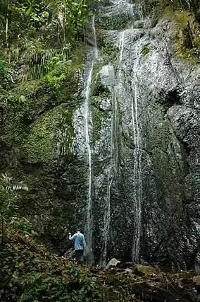
| Pha Daeng National Park | |
|---|---|
| อุทยานแห่งชาติผาแดง | |
 | |
 Location within Thailand | |
| Location | Chiang Dao District, Chiang Mai Province, Thailand |
| Coordinates | 19°37′43.025″N 98°57′21.772″E / 19.62861806°N 98.95604778°E |
| Area | 1,123 km2 (434 sq mi) |
| Established | 2 November 2000 |
| Visitors | 44,741 (in 2019) |
| Governing body | Department of National Parks, Wildlife and Plant Conservation |
Pha Daeng National Park (Thai: อุทยานแห่งชาติผาแดง), formerly known as Chiang Dao National Park,[1] is a national park in Chiang Mai Province, Thailand. Established on 2 November 2000, the park covers 702,085 rai ~ 1,123 square kilometres (434 sq mi)[2] of the Pha Daeng mountain areas of the Daen Lao Range near the border with Burma, just north of Chiang Dao Wildlife Sanctuary. The tallest summit is 1,794 m high Doi Puk Phakka.[3]
Gallery
 Pha Daeng National Park in Chiang Dao District
 Pha Daeng National Park in Chiang Dao District
See also
References
- ↑ "Pha Daeng National Park". National Parks Thailand (in Thai). Dept of National Parks Thailand. Retrieved 2016-07-14.
- ↑ "ข้อมูลพื้นที่อุทยานแห่งชาติ ที่ประกาศในราชกิจจานุบกษา 133 แห่ง" [National Park Area Information published in the 133 Government Gazettes]. Department of National Parks, Wildlife and Plant Conservation (in Thai). December 2020. Retrieved 1 November 2022, no 99
{{cite web}}: CS1 maint: postscript (link) - ↑ "Pha Daeng National Park". National Parks Thailand. Dept of National Parks Thailand. Archived from the original on 2014-12-08. Retrieved 2014-12-06.
External links
Wikimedia Commons has media related to Pha Daeng National Park.
 Chiang Dao travel guide from Wikivoyage
- Birdwatching, Doi Chiang Dao National Park
This article is issued from Wikipedia. The text is licensed under Creative Commons - Attribution - Sharealike. Additional terms may apply for the media files.