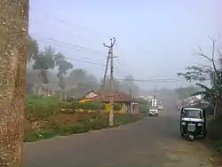
Chemmannar | |
|---|---|
Village | |
 | |
 Chemmannar Location in Kerala, India  Chemmannar Chemmannar (India) | |
| Coordinates: 9°50′35″N 77°09′07″E / 9.843°N 77.1519°E | |
| Country | |
| State | Kerala |
| District | Idukki |
| Government | |
| • Type | Panchayath |
| • Body | Udumbanchola grama panchayath |
| Area | |
| • Total | 51.95 km2 (20.06 sq mi) |
| Population (2011) | |
| • Total | 9,969 |
| • Density | 160/km2 (400/sq mi) |
| Languages | |
| • Official | Malayalam, English |
| Time zone | UTC+5:30 (IST) |
| PIN | 685554, 685566 |
| Telephone code | 04868 |
| Vehicle registration | KL-69, KL-37 |
| Nearest cities | Kattappana, Nedumkandam, Adimaly, Rajakad Kumily |
| Climate | cold climate which may come down to 5c (Köppen) |
| Website | www.lsgkerala.in/nedumkandamblock |
Chemmannar is a village in the High ranges of Idukki district, Kerala, India.
Geography
References
Wikimedia Commons has media related to Chemmannar.
External links
This article is issued from Wikipedia. The text is licensed under Creative Commons - Attribution - Sharealike. Additional terms may apply for the media files.
