Borghetto d'Arroscia | |
|---|---|
| Comune di Borghetto d'Arroscia | |
 Church | |
Location of Borghetto d'Arroscia | |
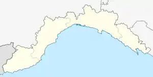
 Borghetto d'Arroscia Location of Borghetto d'Arroscia in Italy  Borghetto d'Arroscia Borghetto d'Arroscia (Liguria) | |
| Coordinates: 44°3′N 7°59′E / 44.050°N 7.983°E | |
| Country | Italy |
| Region | Liguria |
| Province | Province of Imperia (IM) |
| Frazioni | Gavenola, Gazzo, Leverone, Montecalvo, Ubaga, Ubaghetta |
| Area Luca Ronco | |
| • Total | 25.95 km2 (10.02 sq mi) |
| Elevation | 155 m (509 ft) |
| Population (30 April 2017)[1] | |
| • Total | 455 |
| • Density | 18/km2 (45/sq mi) |
| Demonym | Borghettini |
| Time zone | UTC+1 (CET) |
| • Summer (DST) | UTC+2 (CEST) |
| Postal code | 18020 |
| Dialing code | 0183 |
| Website | Official website |
Borghetto d'Arroscia (Ligurian: O Borghetto d'Areuscia, locally Burghettu) is a comune (municipality) in the Province of Imperia in the Italian region Liguria, located about 90 kilometres (56 mi) southwest of Genoa and about 20 kilometres (12 mi) north of Imperia.
Borghetto d'Arroscia borders the following municipalities: Aquila di Arroscia, Caprauna, Casanova Lerrone, Pieve di Teco, Ranzo, and Vessalico. It gets its name from the Arroscia, a large creek flowing down from Ligurian Alps.
References
This article is issued from Wikipedia. The text is licensed under Creative Commons - Attribution - Sharealike. Additional terms may apply for the media files.