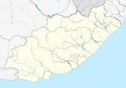
Bluewater Bay | |
|---|---|
 Bluewater Bay  Bluewater Bay | |
| Coordinates: 33°51′24″S 25°37′46″E / 33.85667°S 25.62944°E | |
| Country | South Africa |
| Province | Eastern Cape |
| Municipality | Nelson Mandela Bay |
| Main Place | Port Elizabeth |
| Area | |
| • Total | 3.70 km2 (1.43 sq mi) |
| Population | |
| • Total | 4,530 |
| • Density | 1,200/km2 (3,200/sq mi) |
| Racial makeup (2011) | |
| • Black African | 36.29% |
| • Coloured | 6.80% |
| • Indian/Asian | 1.57% |
| • White | 54.64% |
| • Other | 0.71% |
| First languages (2011) | |
| • Afrikaans | 34.86% |
| • English | 34.74% |
| • Xhosa | 24.52% |
| • Sesotho | 1.44% |
| • Other | 1.22% |
| Time zone | UTC+2 (SAST) |
| Postal code (street) | 6001 |
| PO box | 6019 |
Bluewater Bay is a small seaside suburb located along the Algoa Bay between Port Elizabeth (now Gqeberha) and Coega in the Eastern Cape, South Africa.
Geography
Bluewater Bay is situated approximately 15 kilometres (9,3 miles) north of the city of Port Elizabeth on the mouth of the Swartkops River, with a little break between the suburb and the northern outskirts of Port Elizabeth to the south.[2]
Bluewater Bay consists of two main neighbourhoods: Bluewater Bay and Bluewater Beach. As its name suggests, Bluewater Beach is on the coast while ironically Bluewater Bay is inland of the N2 highway which cuts through the suburb.
Bluewater Bay is neighboured by St George's Strand to the north and Amsterdamhoek to the west. Further notable surrounding areas include Deal Party to the south, Swartkops to the southwest, Motherwell and Markman to the north and the Coega SEZ to the northeast.
Contemporary lifestyle
Bluewater Bay is today being developed as a residential suburb or exurb on the northern outskirts of the Port Elizabeth metropolitan area and has become a bedroom community filled with complexes, flats, bed and breakfasts and suburban-style houses with much of its working population travelling to Port Elizabeth to work or study.
However, in the face of suburban development, Bluewater Bay has still managed to retain its laid-back coastal atmosphere due to its relative isolation from Port Elizabeth which has made it an appealing area for residents who wish to live a serene coastal lifestyle far from the city.
Retail
The only shopping centre in Bluewater Bay is the N2 City Shopping Centre anchored by Superspar, and within the same area is a PicknPay store and an Engen petrol station. However, due to the small size of the shopping centre the variety of goods sold is limited, and for larger shopping trips, residents need to make the short journey to nearby Port Elizabeth.
Road Infrastructure
Bluewater Bay is bisected by the N2 highway which runs through the town in a north–south direction from Grahamstown (now Makhanda) to Port Elizabeth (now Gqeberha) with an interchange at Weinronk Way. The N2 serves as the main route connecting Bluewater Bay to the rest of the city of Port Elizabeth.
The M2 is the main local route through Bluewater Bay and serves as the main linkage between the neighbourhoods of Bluewater Bay and Bluewater Beach as Weinronk Way. It continues through Bluewater Bay as Hillcrest Drive, Riverside Drive and Tippers Creek and continues as Amsterdamhoek Drive straddling along the Swartkops River and leading towards the neighbouring riverside village of Amsterdamhoek.
References
- 1 2 census 2011
- ↑ "Travel South Africa". distancecalculator.co.za. Retrieved 2021-01-29.