| Blees | |
|---|---|
 | |
 | |
| Location | |
| Country | Luxembourg |
| Physical characteristics | |
| Source | |
| • location | Hosingen-Dickt |
| • elevation | 500 m (1,600 ft) |
| Mouth | Sauer |
• location | Bleesbruck |
• coordinates | 49°52′15″N 6°11′24″E / 49.8708°N 6.1899°E |
| Length | 14 km (8.7 mi) |
| Basin features | |
| Progression | Sauer→ Moselle→ Rhine→ North Sea |
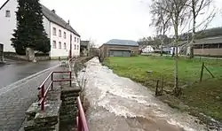
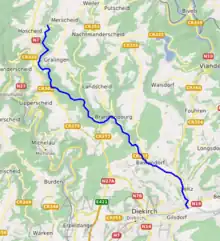
The Blees is a river flowing through Luxembourg, joining the Sauer at Bleesbruck. It flows through the towns of Hosingen, Brandenbourg, and Bastendorf.
This article is issued from Wikipedia. The text is licensed under Creative Commons - Attribution - Sharealike. Additional terms may apply for the media files.