| Mount Beshtau | |
|---|---|
| Бештау | |
 | |
| Highest point | |
| Elevation | 1,401 m (4,596 ft) |
| Coordinates | 44°4′36.62″N 43°0′53.64″E / 44.0768389°N 43.0149000°E |
| Naming | |
| Etymology | from Turkic beş 'five' and tau 'mountain' |
| Native name | Бештау (Russian) |
| Geography | |
 Mount Beshtau | |
| Country | |
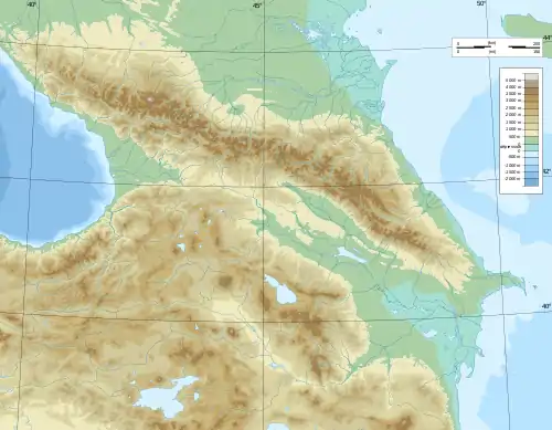
| District | Northern Caucasus |
| City | near Pyatigorsk |
| Parent range | Greater Caucasus |
| Geology | |
| Mountain type | Volcano |
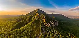
Beshtau (Russian: Бештау, from Turkic beş 'five' and tau 'mountain') is an isolated five-domed igneous mountain (volcano) near Pyatigorsk (after the Russian term Pyatigorye 'area of five mountains') in the Northern Caucasus.[1][2][3]

View of Mount Beshtau from the top of Mount Mashuk (Машук)
Its height is 1,401 m (4,596 ft). The slopes are forested with ash, oak, hornbeam, and beech deciduous forests, and the summit is treeless. Beshtau used to have uranium mines, which were closed in 1975.
See also
External links
References
- ↑ "Пятигорье". www.booksite.ru. Retrieved 2022-04-23.
- ↑ "Зимнее восхождение на гору Бештау совершат около 800 человек". tass.ru. Retrieved 2022-04-23.
- ↑ "Пятигорье - это... Что такое Пятигорье?". Словари и энциклопедии на Академике (in Russian). Retrieved 2022-04-23.
This article is issued from Wikipedia. The text is licensed under Creative Commons - Attribution - Sharealike. Additional terms may apply for the media files.