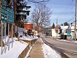
Bedford | |
|---|---|
 | |
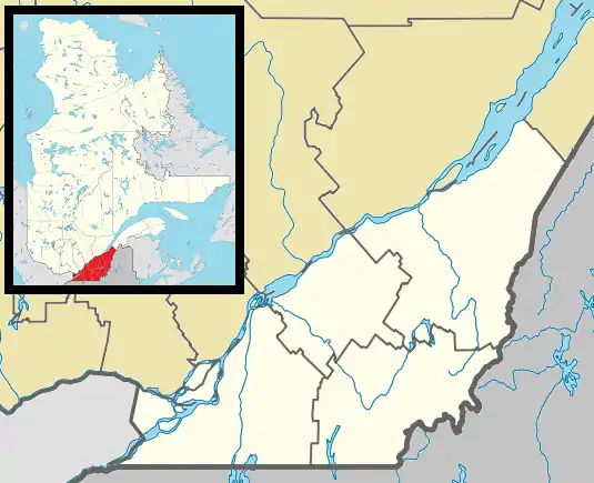
_Quebec_location_diagram.PNG.webp) Location within Brome-Missisquoi RCM. | |
 Bedford Location in southern Quebec. | |
| Coordinates: 45°07′N 72°59′W / 45.117°N 72.983°W[1] | |
| Country | Canada |
| Province | Quebec |
| Region | Estrie |
| RCM | Brome-Missisquoi |
| Constituted | November 21, 1866 |
| Government | |
| • Mayor | Claude Dubois |
| • Federal riding | Brome—Missisquoi |
| • Prov. riding | Brome-Missisquoi |
| Area | |
| • Total | 4.40 km2 (1.70 sq mi) |
| • Land | 4.20 km2 (1.62 sq mi) |
| Elevation | 53 m (174 ft) |
| Population (2011)[4] | |
| • Total | 2,684 |
| • Density | 639.4/km2 (1,656/sq mi) |
| • Pop 2006-2011 | |
| • Dwellings | 1,276 |
| Time zone | UTC−5 (EST) |
| • Summer (DST) | UTC−4 (EDT) |
| Postal code(s) | |
| Area code(s) | 450 and 579 |
| Highways | |
| Exchange# | 248 |
| GNBC Code | EFMFP |
| NTS Map | 31H2 Cowansville |
| Geocode | 2446035 |
| People | Bedfordite |
Bedford (French pronunciation: [bɛdfœʁd]) is a city located in the Estrie region of southern Quebec, Canada. The population as of the Canada 2011 Census was 2,684. This small community is just an hour's drive from larger cities such as Burlington and Montreal.
History
The first settlers arrived in 1812.
Origin of the name
The name "Bedford" could have been given by Loyalists who knew of several Bedfords back in the former American colonies. The name could also have been a tribute to Lord John Russell, who was the fourth Duke of Bedford (1710–1771), an English politician and Secretary of State (1748–1751), and governor general of Ireland from 1756 to 1761.
Geography
Bedford is part of Brome-Missisquoi Regional County Municipality, in the administrative region of Estrie.
The town, located 86 kilometres (53 mi) southeast of Montreal, is completely enclaved within the township of Bedford. Seated in the Saint-Lawrence lowlands, at the beginning of the steppe leading to the Appalachian Mountains, the town is separated into north and south parts by the Pike River (Rivière aux Brochets).
Demographics
| Year | Pop. | ±% |
|---|---|---|
| 1991 | 2,665 | — |
| 1996 | 2,748 | +3.1% |
| 2001 | 2,667 | −2.9% |
| 2006 | 2,612 | −2.1% |
| 2011 | 2,684 | +2.8% |
In the 2021 Census of Population conducted by Statistics Canada, Bedford had a population of 2,558 living in 1,233 of its 1,324 total private dwellings, a change of -0.1% from its 2016 population of 2,560. With a land area of 4.23 km2 (1.63 sq mi), it had a population density of 604.7/km2 (1,566.2/sq mi) in 2021.[6]
| 2021 | 2011 | |
|---|---|---|
| Population | 2,558 (-0.1% from 2016) | 2,684 (+2.8% from 2006) |
| Land area | 4.23 km2 (1.63 sq mi) | 4.20 km2 (1.62 sq mi) |
| Population density | 604.3/km2 (1,565/sq mi) | 639.4/km2 (1,656/sq mi) |
| Median age | 50.4 (M: 48.8, F: 52.4) | 46.8 (M: 44.6, F: 48.2) |
| Private dwellings | 1,324 (total) 1,233 (occupied) | 1,276 (total) |
| Median household income | $$55,600 | $36,266 |
| Canada Census Mother Tongue - Bedford (city), Quebec[5] | ||||||||||||||||||
|---|---|---|---|---|---|---|---|---|---|---|---|---|---|---|---|---|---|---|
| Census | Total | French |
English |
French & English |
Other | |||||||||||||
| Year | Responses | Count | Trend | Pop % | Count | Trend | Pop % | Count | Trend | Pop % | Count | Trend | Pop % | |||||
2011 |
2,555 |
1,910 | 74.76% | 540 | 21.14% | 70 | 2.74% | 35 | 1.37% | |||||||||
2006 |
2,460 |
1,865 | 75.81% | 495 | 20.12% | 45 | 1.83% | 55 | 2.24% | |||||||||
2001 |
2,565 |
1,905 | 74.27% | 525 | 20.47% | 50 | 1.95% | 85 | 3.31% | |||||||||
1996 |
2,630 |
2,075 | n/a | 78.90% | 525 | n/a | 19.96% | 15 | n/a | 0.57% | 15 | n/a | 0.57% | |||||
Parishes
- Roman Catholic Church
- Saint Mitchels Parish
- Le frontere Perish
- The Anglican Parish of Bedford, Philipsburg and Farnham
- United Church
Activities
Every year since 1828, at the beginning of August, the town holds its annual fair, the oldest of its kind in Quebec and the second oldest in Canada. One can figure skate, or play hockey or curling, at the Centre sportif. Every year since 1969, Bedford has held a PeeWee hockey exchange with Kensington, PEI.
Schools
- École primaire et secondaire Monseigneur-Desranleau (French)
- École primaire du Premier Envol (French)
- Butler Elementary (English 1-7)
Notable people
- Georges Thurston (1951–2007) a.k.a. Boule Noire, R&B singer for 30 years.
- Pierre Paradis (1950-), Member of National Assembly of Quebec for 25 years and former Cabinet Minister
- Marcellus Gilmore Edson (1849-1940), chemist who invented peanut butter.
See also
References
- ↑ "Banque de noms de lieux du Québec: Reference number 4594". toponymie.gouv.qc.ca (in French). Commission de toponymie du Québec.
- 1 2 "Ministère des Affaires municipales, des Régions et de l'Occupation du territoire: Frelighsburg". Archived from the original on 2012-05-06. Retrieved 2012-03-11.
- ↑ "Parliament of Canada Federal Riding History: BROME--MISSISQUOI (Quebec)". Archived from the original on 2009-06-09. Retrieved 2009-04-20.
- 1 2 2011 Statistics Canada Census Profile: Bedford, Quebec
- 1 2 Statistics Canada: 1996, 2001, 2006, 2011 census
- ↑ "Population and dwelling counts: Canada, provinces and territories, and census subdivisions (municipalities), Quebec". Statistics Canada. February 9, 2022. Retrieved August 29, 2022.
- ↑ "2021 Community Profiles". 2021 Canadian Census. Statistics Canada. February 4, 2022. Retrieved 2023-10-19.
- ↑ "2011 Community Profiles". 2011 Canadian Census. Statistics Canada. March 21, 2019. Retrieved 2014-03-11.
- ↑ "2006 Community Profiles". 2006 Canadian Census. Statistics Canada. August 20, 2019.
- ↑ "2001 Community Profiles". 2001 Canadian Census. Statistics Canada. July 18, 2021.