| Beaver Brook | |
|---|---|
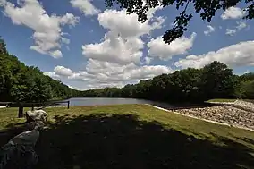
 The source of Beaver Brook | |
| Location | |
| Country | United States |
| State | Connecticut |
| Towns | Windham, Scotland |
| Physical characteristics | |
| Source | |
| • location | Bibbins Pond, Windham |
| • coordinates | 41°43′49″N 72°07′32″W / 41.7303°N 72.1255°W |
| Mouth | |
• location | Merrick Brook, Scotland |
• coordinates | 41°40′46″N 72°06′32″W / 41.6794°N 72.1090°W |
| Length | 5 mi (8.0 km) |
| Width | |
| • minimum | 6.5 ft (2.0 m) |
| • average | 26.3 ft (8.0 m) |
| • maximum | 805 ft (245 m) |
| Basin features | |
| Landmarks | Beaver Brook State Park |
| Population | 3,000 |
| Waterbodies | Unnamed Pond |
| Bridges | |
Beaver Brook is a stream that runs through Windham and Scotland, Windham County, Connecticut. It is currently five miles long. It begins at Beaver Brook State Park in Windham, Connecticut, and flows down to Merrick Brook in Scotland, Connecticut. A saw shop named after it is located near the border between the two towns.[1][2][3][4][5][6]
Crossings
| Town | Crossing |
|---|---|
| Windham | Back Rd. |
| Bass Rd. | |
| Brooklyn Tpk. | |
| Scotland | |
| Bass Rd. | |
| Merrick Brook |
References
- ↑ "Protected Open Space in Scotland, Connecticut". Connecticut Environmental Conditions Online. Connecticut Department of Energy & Environmental Protection. August 2011. Retrieved September 21, 2016.
- ↑ Hemphill, Tom. "The Huntington House in Scotland, Connecticut: The Family". huntingtonhomestead.org. Retrieved October 14, 2016.
- ↑ "Scotland, Windham County, Connecticut History". Connecticut Genealogy. August 9, 2011. Retrieved October 14, 2016.
- ↑ "Rivers & Streams | eRegulations". eRegulations. Retrieved October 14, 2016.
- ↑ "Scotland CT 1869 Map with Homeowners Names Shown Genealogy Family Tree • CAD 15.87". PicClick CA. Retrieved October 14, 2016.
- ↑ "TOWN OF SCOTLAND, CONNECTICUT INLAND WETLANDS AND WATERCOURSES REGULATIONS" (PDF). Scotland, CT. Town of Scotland, CT. June 4, 2008. Retrieved October 14, 2016.
This article is issued from Wikipedia. The text is licensed under Creative Commons - Attribution - Sharealike. Additional terms may apply for the media files.