| Batura Glacier | |
|---|---|
| بتوراگلیشیئر | |
 Batura Glacier Location in Pakistan  Batura Glacier Batura Glacier (Gilgit Baltistan) | |
| Type | Mountain glacier |
| Location | Gilgit Baltistan, Pakistan |
| Coordinates | 36°32′N 74°39′E / 36.533°N 74.650°E |
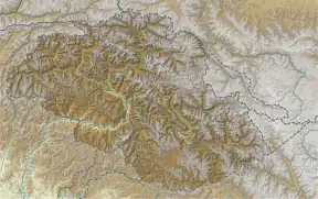
Batura Glacier (Urdu: بتورا گلیشیر), 57 km (35 mi) long, is one of the largest and longest glaciers outside of the polar regions.[1] It lies in the upper Hunza (Gojal) region of Hunza District, Gilgit-Baltistan in Pakistan. It is just north of the massifs of Batura, at 7,795 metres (25,574 ft), and Passu, at 7,500 metres (24,600 ft). The glacier flows west to east. The lower portions can be described as a grey sea of rocks and gravelly moraine, bordered by a few summer villages and pastures with herds of sheep, goats, cows and yaks and where roses and juniper trees are common.
See also
References
- ↑ Tajikistan's Fedchenko Glacier is 77 km (48 mi) long, Siachen Glacier is 76 km (47 mi) long, Biafo Glacier 67 km (42 mi) long, and Baltoro Glacier 63 km (39 mi) long. The Bruggen or Pio XI Glacier in southern Chile is 66 km long. Measurements are from recent imagery, generally supplemented with Russian 1:200,000 scale topographic mapping as well as Jerzy Wala,Orographical Sketch Map: Karakoram: Sheets 1 & 2, Swiss Foundation for Alpine Research, Zurich, 1990.
External links
Wikimedia Commons has media related to Batura glacier.
- Northern Pakistan detailed placemarks in Google Earth Archived 2012-02-04 at the Wayback Machine
This article is issued from Wikipedia. The text is licensed under Creative Commons - Attribution - Sharealike. Additional terms may apply for the media files.