Bafatá | |
|---|---|
_(2).jpg.webp) | |
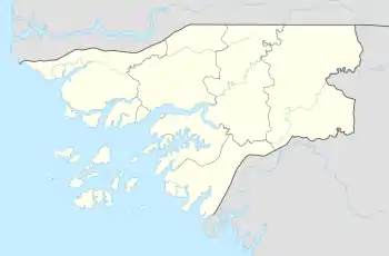
 Bafatá Location in Guinea-Bissau  Bafatá Bafatá (Africa) | |
| Coordinates: 12°10′19″N 14°39′27″W / 12.17194°N 14.65750°W | |
| Country | |
| Admin. Region | Bafatá Region |
| Elevation | 10 m (30 ft) |
| Population (2010) | |
| • Total | 34,760 |
Bafatá is a town in central Guinea-Bissau, known as the birthplace of Amílcar Cabral.[1] The town has a population of 22,501 (2008 est).[2] It is the capital of Bafatá Region as well as the seat of the Roman Catholic Diocese of Bafatá, which was established in March 2001 with Carlos Pedro Zilli as bishop.[3]
Bafatá is noted for its brickmaking.[4] By the 1880s it was an established trading centre for the Portuguese, including peanuts, cattle, hides, textiles, and salt.[5]
Landmarks
The town is served by Bafatá Airport, an airstrip,[6] and a regional hospital.[7] There is a hotel, the Bafatá Apartamento Imel. The restaurant Ponto de Encontro serves Portuguese cuisine. The surrounding forests are noted for their monkey and antelope populations, and Maimama Cape, owned by a Cape Verdean, organizes trips to visit the animals for tourists.[8] The town is in a derelict state; the streets contain tumbleweeds and cracked tarmac.[9] Several of the main avenues are named Bissau, Brazil and Guiana.
Climate
| Climate data for Bafatá (1991–2020) | |||||||||||||
|---|---|---|---|---|---|---|---|---|---|---|---|---|---|
| Month | Jan | Feb | Mar | Apr | May | Jun | Jul | Aug | Sep | Oct | Nov | Dec | Year |
| Mean daily maximum °C (°F) | 34.2 (93.6) |
37.4 (99.3) |
39.0 (102.2) |
39.7 (103.5) |
38.5 (101.3) |
35.2 (95.4) |
31.9 (89.4) |
31.3 (88.3) |
31.8 (89.2) |
33.0 (91.4) |
33.9 (93.0) |
33.5 (92.3) |
35.0 (95.0) |
| Daily mean °C (°F) | 25.4 (77.7) |
27.7 (81.9) |
29.9 (85.8) |
30.8 (87.4) |
30.7 (87.3) |
28.9 (84.0) |
27.2 (81.0) |
26.7 (80.1) |
26.7 (80.1) |
27.4 (81.3) |
27.4 (81.3) |
25.0 (77.0) |
27.8 (82.0) |
| Mean daily minimum °C (°F) | 16.4 (61.5) |
17.9 (64.2) |
20.8 (69.4) |
21.9 (71.4) |
22.9 (73.2) |
22.7 (72.9) |
22.5 (72.5) |
22.1 (71.8) |
21.7 (71.1) |
21.8 (71.2) |
20.8 (69.4) |
16.4 (61.5) |
20.7 (69.3) |
| Average precipitation mm (inches) | 0.2 (0.01) |
0.0 (0.0) |
0.1 (0.00) |
0.2 (0.01) |
24.8 (0.98) |
128.9 (5.07) |
267.8 (10.54) |
344.7 (13.57) |
349.2 (13.75) |
152.4 (6.00) |
3.2 (0.13) |
0.1 (0.00) |
1,271.6 (50.06) |
| Average precipitation days (≥ 1.0 mm) | 0.0 | 0.0 | 0.0 | 0.0 | 2.9 | 9.2 | 16.6 | 23.2 | 26.6 | 10.3 | 1.0 | 0.0 | 89.8 |
| Source: NOAA[10] | |||||||||||||
Gallery
 Bafatá market
 Bafatá, Guinea-Bissau
.jpg.webp) Bafatá, GBW
Bafatá, GBW A residential street in Bafatá
 Catedral de Nossa Senhora da Graça church, Downtown Bafatá
.jpg.webp) Children playing and fishing in the river
Children playing and fishing in the river Regional education administration building of Bafatá
References
- ↑ Chabal, Patrick (2002). Amilcar Cabral: Revolutionary Leadership and People's War. C. Hurst & Co. Publishers. p. 29. ISBN 978-1-85065-548-0.
- ↑ World Gazetteer, Retrieved on June 16, 2008
- ↑ Mendy, Peter Karibe (17 October 2013). Historical Dictionary of the Republic of Guinea-Bissau. Scarecrow Press. p. 92. ISBN 978-0-8108-8027-6.
- ↑ Country Profile: Senegal, The Gambia, Guinea-Bissau, Cape Verde. The Unit. 1987.
- ↑ Miller, Joseph C.; Havik, Philip J.; Birmingham, David (15 November 2011). A Scholar for All Seasons: Jill Dias: Portuguese Studies Review, Vol. 19, Nos. 1 and 2 (Special Volume in Memory of Jill Dias, 1944-2008) (ISSN 1057-1515). Baywolf Press. p. 216.
- ↑ Official Records of the ... Session of the General Assembly: Supplement. UN. 1947.
- ↑ La mortalité maternelle dans la région de Bafatá (in French). The Département. 1989.
- ↑ Trillo, Richard (2 June 2008). The Rough Guide to West Africa. Rough Guides Limited. p. 1298. ISBN 978-1-4053-8068-3.
- ↑ Ham, Anthony (2009). West Africa. Lonely Planet. p. 447. ISBN 978-1-74104-821-6.
- ↑ "World Meteorological Organization Climate Normals for 1991-2020 — Bafatá". National Oceanic and Atmospheric Administration. Retrieved January 4, 2024.