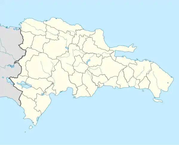
Native name: Isla Alto Velo | |
|---|---|
 Alto Velo Island | |
| Geography | |
| Coordinates | 17°28′41.5″N 71°38′04.9″W / 17.478194°N 71.634694°W |
| Area | 1 km2 (0.39 sq mi) |
| Administration | |
| Province | Pedernales Province |
| Demographics | |
| Population | 0 |
| Pop. density | 0/km2 (0/sq mi) |
| Isla Alto Velo Lighthouse | |
| Constructed | 1915 |
| Construction | concrete (tower) |
| Height | 20 m (66 ft) |
| Shape | quadrangular tower with balcony and lantern |
| Markings | white (tower) |
| Operator | Jaragua National Park |
| Deactivated | 1980s |
| Focal height | 163 m (535 ft) |
| Range | 13 nmi (24 km; 15 mi) |
| Characteristic | Fl(2) W 10s |
Alto Velo Island (Spanish: Isla Alto Velo; also called Alta Vela Island) is a small uninhabited island south of the island of Hispaniola in the Caribbean Sea. Its maximum height is about 152 metres (499 ft) above sea level.[1] It lies on an underwater mountain range which continues to Beata Island (about 12 km (6.5 nmi) away, separated by the Alto Velo Channel) and the southwestern coast of the Dominican Republic. It has an area of 1.02 km2 (0.39 sq mi)[2] and is 1.4 km (0.87 mi) long, being oval in shape.
Location
It is located about 220 km (120 nmi) southwest of Santo Domingo, and 74 km (40 nmi) south of Pedernales, making it the southernmost point of the Dominican Republic, a distinction sometimes claimed by Beata Island.
Government
The island is part of the province of Pedernales in the Dominican Republic.
Conservation
Alto Velo and Beata Islands belong to the Jaragua National Park,[3][4] the largest protected area in the Caribbean region.
History
The island was visited by Christopher Columbus on his second voyage in 1494; his crew caught and killed seabirds and eight Caribbean monk seals on the island,[5] which he named Alta Vela because from a distance it looked like a tall ship at sail.[6]
In 1863, the Confederate commerce raider CSS Alabama captured and burned at sea the Boston-based schooner Chatelaine off the coast of Alto Velo Island.[7]
In the 1860s, at least three U.S.-based companies claimed the island under the Guano Islands Act; however, the U.S. Department of State determined that the island, despite lying in an area then-disputed between Haiti and the Dominican Republic, likely belonged to the Dominican Republic (due to historical Spanish claims, geography, and other factors) and therefore could not be claimed under the act.[8] A 1932 U.S. Department of State report on the status of Guano Island Act claims included Alto Velo among the islands "to which the United States has no claim."[9]
Dominican officials authorized foreign concessionaires to mine guano from the island until the early 20th century, when synthetic fertilizers became common. A 1950 botanical expedition to Alto Velo noted that "the scars of the mining operations on the leeward slopes of the island" remained visible and that "artifacts of mining still litter portions of the hill."[6]
See also
References
- ↑ Mi Pais Geografia. "Isla Alto Velo" (in Spanish). Retrieved 2010-09-24.
- ↑ BirdLife IBA Factsheet DO007: Jaragua National Park
- ↑ The Nature Conservancy. "Parque Nacional Jaragua" (in Spanish). Archived from the original on 2010-02-20. Retrieved 2010-09-24.
- ↑ Cervantes Virtual. "Colon abandona la busqueda del paso" (PDF) (in Spanish). Retrieved 2010-09-24.
- ↑ Ellis, Richard (2003). The Empty Ocean. Washington, D.C. Island Press. p. 208. ISBN 978-1-55963-974-3.
- 1 2 Howard, Richard A. (1955). "The Vegetation of Beata and Alta Vella Islands, Hispaniola". Journal of the Arnold Arboretum. 36 (2/3): 209–240. doi:10.5962/bhl.part.24327. JSTOR 43790872.
- ↑ Kell, John McIntosh (1900). Recollections of a Naval Life: Including the Cruises of the Confederate States Steamers, "Sumter" and "Alabama". Washington, D.C.: The Neale Company. p. 211. ISBN 9780598629630. Retrieved October 7, 2021.
... she lit up the heights of Alta Vela, a mountain of rock about fifteen miles from the mainland of San Domingo, and frightened the sea birds, if there were no other eyes to witness the conflagration.
- ↑ Seward, William Henry (1868). Alto Velo Island. Report of the Secretary of State on the Claim of Patterson and Murguiendo with a Further Argument of the Claimants. Washington, D.C.: U.S. Government Printing Office.
- ↑ Rogers, E.S. (September 30, 1932). "Part II, Islands to which the United States Has No Claim" (PDF). The Sovereignty of Guano Islands in the Caribbean Sea (Report). Department of State, Office of the Legal Advisor. pp. 67–80. Archived from the original (PDF) on September 14, 2021. Retrieved September 14, 2021.
Further reading
- Messamore, Ford W.; Johnson, Andrew (1943). Alta Vela: A Forgotten Isle of the Caribbean. The Lycoming Press.
- Seward, William Henry (1868). Alto Velo Island. Report of the Secretary of State on the Claim of Patterson and Murguiendo [sic] with a Further Argument of the Claimants. Washington, D.C.: U.S. Government Printing Office.
- Rowlett, Russ. "Lighthouses of the Dominican Republic". The Lighthouse Directory. University of North Carolina at Chapel Hill. Retrieved 8 September 2016.
- List of Lights, Buoys and Fog Signals Atlantic Coast. Retrieved 8 September 2016