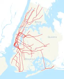
52nd Street | |||||||||||||||||||||||||||||||
|---|---|---|---|---|---|---|---|---|---|---|---|---|---|---|---|---|---|---|---|---|---|---|---|---|---|---|---|---|---|---|---|
| Former New York City Subway station | |||||||||||||||||||||||||||||||
| Station statistics | |||||||||||||||||||||||||||||||
| Address | 3rd Avenue and 52nd Street Brooklyn, NY 11220 | ||||||||||||||||||||||||||||||
| Borough | Brooklyn | ||||||||||||||||||||||||||||||
| Locale | Sunset Park | ||||||||||||||||||||||||||||||
| Coordinates | 40°38′47.95″N 74°0′57.32″W / 40.6466528°N 74.0159222°W | ||||||||||||||||||||||||||||||
| Division | B (BMT)[1] | ||||||||||||||||||||||||||||||
| Services | BMT Fifth Avenue Line | ||||||||||||||||||||||||||||||
| Structure | Elevated | ||||||||||||||||||||||||||||||
| Platforms | 1 island platform | ||||||||||||||||||||||||||||||
| Tracks | 2 | ||||||||||||||||||||||||||||||
| Other information | |||||||||||||||||||||||||||||||
| Opened | October 1, 1893 | ||||||||||||||||||||||||||||||
| Closed | May 31, 1940[2] | ||||||||||||||||||||||||||||||
| Station succession | |||||||||||||||||||||||||||||||
| Next north | 46th Street | ||||||||||||||||||||||||||||||
| Next south | 58th Street | ||||||||||||||||||||||||||||||
| |||||||||||||||||||||||||||||||
| |||||||||||||||||||||||||||||||
| |||||||||||||||||||||||||||||||
The 52nd Street station[3][4][5] was a station on the demolished section of the BMT Fifth Avenue Line in Brooklyn, New York City. It was served by trains of the BMT Fifth Avenue Line, it had 2 tracks and 1 island platform. The station was opened on October 1, 1893, at the intersection of Third Avenue and 52nd Street. The next stop to the north was 46th Street. The next stop to the south was 58th Street. It closed on May 31, 1940. Current rapid transit service in this area can be found one block east and then another block south at the 53rd Street station on the underground BMT Fourth Avenue Line.
References
- ↑ "Glossary". Second Avenue Subway Supplemental Draft Environmental Impact Statement (SDEIS) (PDF). Vol. 1. Metropolitan Transportation Authority. March 4, 2003. pp. 1–2. Archived from the original (PDF) on February 26, 2021. Retrieved January 1, 2021.
- ↑ "Plans Pushed to Mark Fulton 'L's" Last Run". The Brooklyn Daily Eagle. May 27, 1940. p. 12. Retrieved October 16, 2019 – via Brooklyn Public Library; newspapers.com
 .
. - ↑ 1912 BRT Map (NYCSubway.org)
- ↑ 1924 BMT Map (NYCSubway.org)
- ↑ 1939 BMT Map (NYCSubway.org)
External links
This article is issued from Wikipedia. The text is licensed under Creative Commons - Attribution - Sharealike. Additional terms may apply for the media files.


